Warmer weather is on its way to Ukraine, but forecasters have warned of frost
2 May 07:36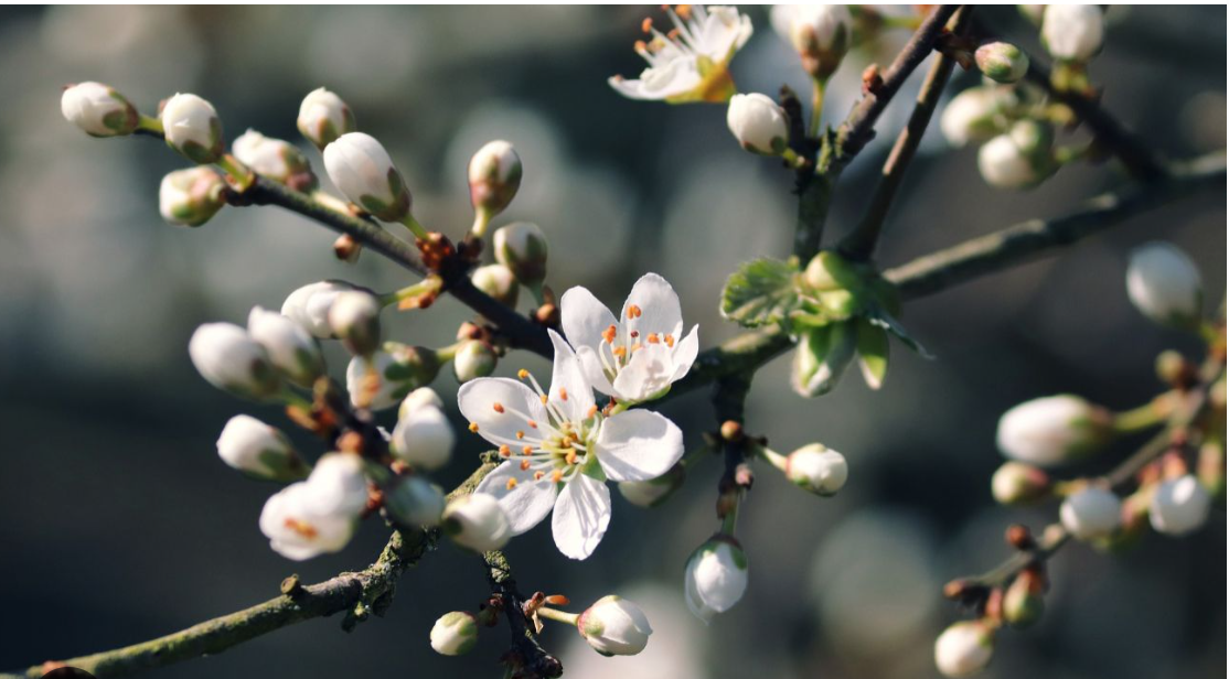
After a prolonged cold snap, warmer weather is finally returning to Ukraine. Arctic air is gradually retreating eastward, giving way to a high-pressure system that will bring dry and mostly sunny weather. However, forecasters warn that frosts are still possible at night, and temperatures may drop again next weekend, reports "Komersant Ukrainian"
According to forecaster Natalka Didenko, it will become noticeably warmer in Ukraine as early as May 2–3.
What will the weather be like on May 2?
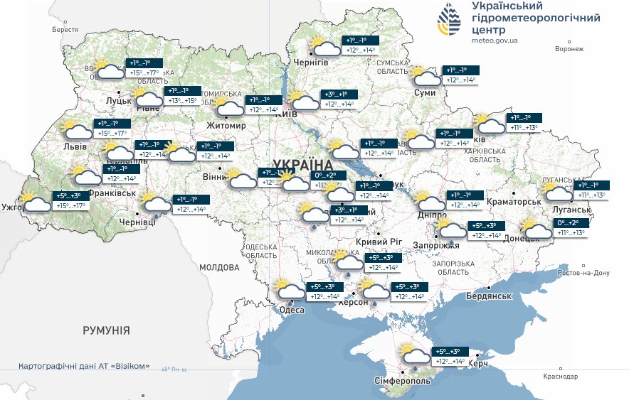
On Saturday, daytime temperatures will mostly range from 9 to 13°C, and in western regions from 12 to 16°C. On Sunday, the warming trend will intensify: most regions are expected to see temperatures of 12 to 17°C, and in the west, up to 16 to 22°C.
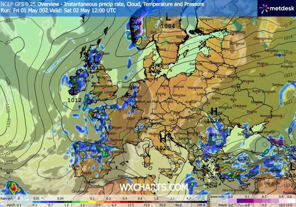
According to the Ukrainian Hydrometeorological Center, on Saturday, May 2, Ukraine is expected to have mostly cloudy weather with some sunny intervals. No significant precipitation is forecast for most regions, though light rain is possible in some areas of the south during the day.
At night, most regions will still face a risk of frost, with air temperatures ranging from 0 to -3°C.
In the southern part of the country, it will be warmer at night—1…6°C. During the day, temperatures will range from 10…15°C, and in the far west, they will rise to 18°C in some places.
Forecast for May 3
On Sunday, May 3, the warming trend will become more noticeable. According to Natalka Didenko’s forecast, temperatures in most regions will reach 12–17°C, and in western regions—16–22°C.
Forecasters do not predict strong winds. The weather will be mostly dry and sunny due to the influence of an anticyclone.
Light rain is possible only locally—specifically in the Chernivtsi and Kherson regions and in Crimea.
“It will get even warmer in Ukraine this week, up to 17–24 degrees, but next weekend the air temperature will drop slightly again,” Didenko predicts.
Watch us on YouTube: important topics – without censorship
High-pressure system Winfried is pushing out the Arctic cold
According to the forecast by Vitaliy Postrygan, head of the Cherkasy Hydrometeorological Center, the atmosphere is gradually shifting to a warmer regime.
The Arctic air mass is retreating eastward, and Ukraine is coming under the influence of the Winfried anticyclone.
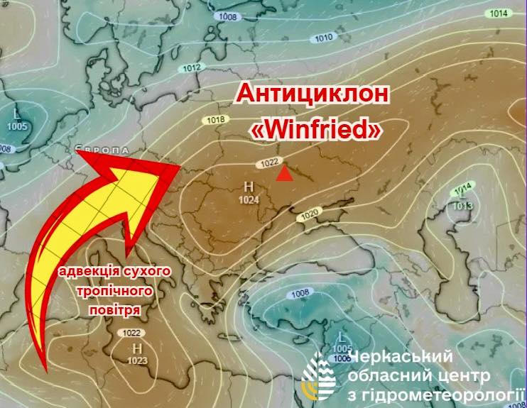
This means that in the coming days it will become drier, sunnier, and warmer. However, nighttime cooling will persist, so frosts will not completely subside immediately.
When will it get truly warm?
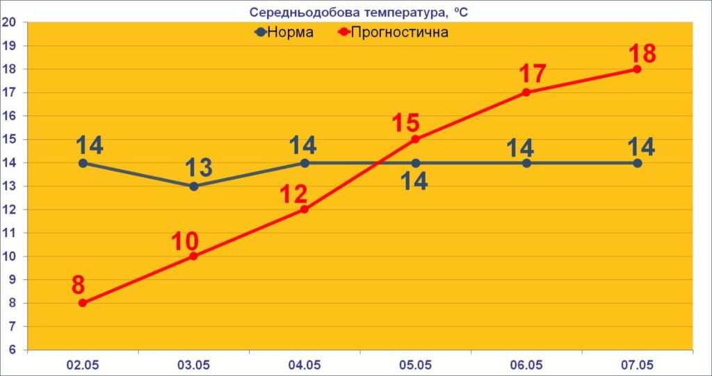
Early next week, temperatures in Ukraine will continue to rise. According to Didenko’s forecast, temperatures could reach 17–24°C over the course of the week.
This will be a more noticeable spring warmth following the cold end of April. However, forecasters warn that this weather will not be permanently stable.
When the weather will turn bad again
According to Natalka Didenko’s forecast, temperatures will drop slightly again next weekend. In other words, after a few warm days, a new cold snap is possible, though it won’t be as severe as the previous Arctic cold front.
So, the coming days will be ideal for walks and trips, but gardeners and vegetable growers should keep a close eye on nighttime temperatures.
Why frosts are still dangerous
Even if daytime temperatures rise to comfortable levels, nighttime frosts can damage blooming gardens, berry bushes, seedlings, and early vegetable crops.
Particularly vulnerable:
- apricots;
- cherries;
- cherries;
- plums;
- pears;
- apple trees;
- strawberries;
- planted seedlings.
At temperatures of 0…-3°C, flowers and young fruit buds may be damaged, which will affect the future harvest.
Read us on Telegram: important topics – without censorship